Monday, October 24, 2011

Gray's and Torrey's Peaks

Date of hike: 7/12/11
Distance RT:  8.25 miles, but we went ~8 miles since we took a shortcut switchback on the descend.
Time:  6 hrs
Difficulty: Moderate-Difficult
Permits required: None

Brief Description
This route includes climbing two mountains that are taller than 14,000 feet in elevation (Gray's at 14,270' and Torrey's at 14,267'). Gray's peak is the tallest mountain on the Continental Divide, with Torrey's Peak only a 0.65 mile saddleback hike away.  The beginning of the hikes starts out in lush lowlands with thriving mountain flower fields nearby gushing snow-melt streams. Near 12,000' the trail transforms into a rocky staircase with many switchbacks. The views from both summits provide unique panoramas of summit valley, including Breckenridge ski slopes, Long's Peak, I-70, and high altitude frozen lake.  
Thanks to 14ers.com

Trail Map
The map above shows the trail to the top of Gray's (green) and then Torrey's (blue), beginning from the summer TH parking lot. The trail is a tidy gravel/dirt path in the lowlands, which eventually becomes a rocky footpath twisting up to Gray's summit. This is the standard eastern slope climb (the others sides increasing in difficulty). From the top of Gray's, climb down its rocky north side to continue up to Torrey's Peak.  Although Torrey's Peak is slightly less tall than Gray's, it will seem just as tall (if not more) since this second summit requires another strenuous, steep climb to the top. 

I-70 W from Denver to Exit 221 to Gray's Peak TH (B).
Thanks for Google Maps.

Directions from Denver
-Take I-70 westbound into Summit valley.
-Take exit 221 towards Bakerville. 
-Leave the highway and drive south over to the dirt parking area (for winter parking) near the start of Forest Road 189/Stevens Gulch Road.
-Continue on FR 189 to a junction after about one mile- stay straight and follow the sign for Grays Peak TH (the summer parking).
-Continue another 2 miles to the trailhead parking lot at 11,280'. 

Parking
Public bathrooms (but bring your own toilet paper). No Fee.  Our Honda Civic braved the steep gravel road that extended from the highway to Gray's Peak summer TH. However, parking and hiking from anywhere along FR 189 is common for low-clearance vehicle drivers who wish to save themselves the stress of potential car damage. 

 Personal Notes and Experiences 
The hiking websites grade Gray's Peak as "easy" but we graded both Torrey's and Gray's as "moderate-difficult" because the first three hours of the hike was up, up, up, and more up! The start of the hike through the flowering meadows felt great, even despite our early wake up call at 4:30 AM so that we could make the drive and begin hiking at 6:30 AM. There was good cloud cover so we wore gloves and hats, even at these lower altitudes. 

Starting up around 6:30 AM.
At times it felt as though we were walking
up an old creek bed, and in fact, on the way
back down there were small water streams.
Mountain flowers brightened the otherwise
austere, rocky mountain sides. 

Eventually, we reached an altitude (around 12,000' we are guessing) where the footing beneath us consisted of nothing but rocks. This stretch of our hike was a bit difficult since it was hard to navigate the trail due to a few snowmelt runoffs, sliding rocks, and steep drop offs. Nevertheless, we continued meandering up the long, winding switchbacks until we reached the summit of Gray's. We stopped more often towards the top for water and air. Oxygen was obviously at lower supply, as it felt like our lungs tighten and our pulse beating in our heads and hands as our hearts beat furiously to feed our tiered muscles. The switchbacks seemed to go on forever at first, and in a way, the summit of Gray's came out of nowhere! We looked up at one point and realized that we were almost to the top! 
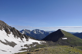
Mid-summit.
A mountain spine.

When we surfaced at the top, we took our first look from 14,000 feet. It was magnificent. The thrill of reaching the top seemed to pump life right back into us as we walked around snapping photos and smiling ear to ear. Many climbers were perched at the top as well, enjoying a mid-morning meal with similar expressions of amazement. We met a mother and son who were hiking Gray's for the first time, just as we were. The mother had hiked Bierstadt Peak (another "14er") three years back, but for her son it was his first 14er. We congratulated each other on surviving the climb. The temperature was quite chilly at this altitude (pack additional layers, hats and gloves). To the north we could see and hear Torrey's Peak calling our names.  As we were preparing to depart towards our second summit, we say a women who we had passed earlier that morning in our car. We were driving to the TH parking lot as she was running up the steep FR 189. We had both agreed that running that road along was gutsy, and now we realize that she had continued her morning run up Gray's, over to Torrey's, and now she was happily jogging down her return route.  What?! Ok, now that is one insanely fit woman!!  We getting quite the challenge just walking!

Gray's Peak summit.
Views as far as the eye could see...
Here we are looking at a frozen mountain lake.


As we descended the rocky saddleback trail (don't miss the stair path!) towards Torrey's, we surveyed the surrounding skis for dark clouds. Being the summer season it is very dangerous to be up on top of a mountain when an afternoon popcorn thunderstorm approaches since your body acts like a lightning rod (this is especially daunting for Emily who is very frightened by being outdoors when there is the threat of lightning).  We saw a few dark clouds in the distance but decided to continue hiking. It was now around 10:30 AM. 

Second summit of the day, Torrey's Peak.
More amazing views.


Our legs felt surprisingly refreshed at the crux of the saddleback, but that didn't last very long. Almost immediately, as we started to climb the rocky switchbacks taking us up to Torrey's Peak, our leg muscles burned with fury and our breath quickened. But. We. Had. To. Reach. The. Top! It took us ~45 minutes to complete the short climb.  At this second summit, we felt exhilarated and totally wiped at the same time.  After a few more pictures, we found two free rocks amongst the crowded peak (there were lots of groups and friends hiking together that day, and many people had brought their dogs too)! We ate our peanut butter sandwiches, some trail mix, and long drags of water from the Camelbak before deciding that we better start our journey down. The dark clouds were moving in quickly and becoming more ominous looking. Our goal was to make it down by noon. 

A snowy shortcut.

To make this possible, and to give our legs a break, we took a shortcut switchback across a snowy slope that began at the bottom of the saddleback trail, that veered off the the left of the trail that would otherwise take you up to Gray's Peak again.  The trail consisted of packed snow from previous hikers' boots. Thank goodness for our multi-weather hiking boots that were able to keep our feet warm and dry  as we made our way through some (sometimes calf-deep) snow banks. During the descend, Emily paid close attention to her footing, as the rocky mountain face provided many opportunities for tripping. The closer we got to the lowlands, the easier it was to breath, and the more energy noticeably came back into our limbs. Also, relative to the dry, snowy conditions near the mountain tops, the temperature felt tropical once we reached the gravel path in the meadows!  Off with the extra layers, hats and gloves. 
This trail was unique from others that we have hiked, in that there were no private outdoor spots to use the restroom if needed (no tall bushes or trees to hide behind), so make sure you don't hydrate with caffeinated beverages beforehand or you may find yourself in trouble, especially for females! 

Parking lot pic.

Upon returning to our car at the TH, we slowly took off our shoes and wound up chatting with a nice older couple in the parking lot from Wyoming.  We had seen them trekking up the Gray's Peak path with alpine skis and boots swung over their shoulders! They told us that they were hiking up just high enough to access a snowy face to freestyle ski back down.  Joe and I had kept our eye on them and, sure enough, they had successfully skied down the mountain!  Their adventurous spirits were inspiring. That same day we learned that there were other unique ways of getting down the mountain in a hurry... sliding!  As we were slowly making our way back down the trail path, we had recognized some hikers that we had seen at the summit of Torrey's sliding down the snowy mountain side on their rear ends in some kind of manmade snow slide!  We will pocket that idea for the next Gray's and Torrey's climb.

Umm... latte.
Driving down eastbound I-70 towards home, we decided to stop off in Georgetown for a hot cup of coffee and a snack.  Dull headaches had settled into both of our brains and a little caffeine sounded rejuvenating now that the climb was over. Plus, it seemed like a celebratory drink to honor our first successful 14er(s) hike!  We found a small cafe called, Mountain Buzz Cafe and Pizzeria.  This place has forever gone down in our books of great cafe finds. The barista whipped up some fantastically frothy espresso drinks and delicious handmade pizzas. We ate and sipped happily while looking west at the mountains we had just climbed.  

Cub Lake Trail

Date of hike: 6/19/11
Distance RT:  4.6 miles
Time:  2 hrs
Difficulty: Easy
Permits required: Yes

Brief Description
This Cub Lake Trail leads on a fairly level grade west through open ares where beaver ponds are common. The trail then passes through a stand of aspen trees and passes the Cub Creek campsites before reaching the marshy area at Cub Lake. This trail has a reputation for being a good trail for viewing wildlife, including elk, ducks, and songbirds.  Description adapted from here

Cub Lake trail.
Larger map can be downloaded here.

Trail Map
The map above shows a zoomed-in snapshot of Moraine Park within the encompassing Rocky Mountain National Park.  Cub Lake trail (a green stitched line) begins at the black dot marked "Cub Lake Trailhead" found in the upper center part of the map. As you can see, it bends south first, then curves west along Cub Creek until it reaches Cub Lake, pictured to the left hand side of the map. Cub Lake marks the return point of this trail, although it continues westward to link up with others if you decide to continue hiking further. 

Denver to Rocky Mountain National Park, Estes Park.
Thanks to Google Maps.

Directions from Denver
-Take Highway I-25 North and exit onto U.S. Highway 36 west towards Boulder. 
-Continue on US-36 W (also marked as CO-66 W) through the town of Lyons (requires following Main Street). 
-After another ~20 miles after Lyons, you will reach the Beaver Meadows Park Entrance Station. 
-From the Entrance Station, head west less than a quarter mile and turn south on Bear Lake Road toward Moraine Park.
-Follow Bear Lake Road about 1.2 miles and turn right toward Fern Lake and Moraine Park campgrounds. 
-Follow this road for about 0.5 miles to another junction and turn left towards Fern Lake and Cub Lake TH.  The Cub Lake parking lot is ~1 mile further.

Parking
No bathrooms. No Fee.  Space is limited. We recommend that you get to the TH early, before 9 or 10 AM to get a spot. There is a park and shuttle option available for free via park service.  Ask the visitors center personnel about these options, as we have not tried this yet. The access roads are very well kept and easy to navigate with a small vehicle. 


Trailhead.

Personal Notes and Experiences 
The Cub Lake trail took us first through a grassy prairie-like area where we quickly encountered a group of grazing elk. At the same moment, we were crossing paths with two Rangers hiking that informed us that the females are called "cows," and we were looking at a group of cows with their small offspring hidden in the tall grasses nearby. They also warned us not to approach them, as friendly as they might look, because they can be very territorial with their young. We also saw other wildlife, such as prairie dogs, mountain chipmunks (with long swatting talks), woodchucks (or some other strange animal), and many squirrels.

Heading westward towards the Rockies.
Mountain runoff.

As we started to hike westward along the Cub Creek, the trail was flooded in a few places from surrounding mountain snow melt. Other than that, the trail was in very good condition, so nice in fact, that some hikers were spotted wearing flip flops!  The trail was fairly crowded with people of all ages enjoying the surrounding flowers and wildlife. We had started around 10:30 am, mid-morning, so that probably had something to do with it.

The marshy Cub Lake, perched from
our lookout boulder.
A friendly (hungry) snack guest.

Once we reached Cub Lake, we climbed a nearby boulder to get some great photos of the marshy lake below, as well as have a snack with some friendly chipmunks. One chipmunk snapped up a stray Cheez It cracker and happily munched on it nearby. Emily felt very tiered on this hike and felt bad slowing down Joe. However, perhaps it was an opportunity to really take in our beautiful mountain surroundings.

A stormy sky hovering above majestic mountains.
Rocky Mountain National Park.

As we were arriving back at our car, some afternoon showers started. We thought about the many hikers that we passed going the opposite direction out (we hope they had ponchos)! Before we left the Rocky Mountain National Forest, we drove to a look out spot along Upper Beaver Meadows and ate peanut butter and jelly sandwiches while listening to "Girl Who Plays with Fire," while taking in a rare site: an elk bull playing tag with a group of cows as a large, dark thunderhead with lightning formed behind the nearby mountains. 

Wednesday, October 19, 2011

Royal Arch Trail

Date of hike: 6/12/11
Distance RT:  3.5 miles
Time:  1 hrs 40 min
Difficulty: Moderate
Permits required: None

Brief Description:  
Royal Arch rock formation is perched high along a rugged fold within Boulder's Flatiron rock formations. The Royal Arch trail is only ~1 mile each way, however, it can only be accessed by taking the Bluebell Road trail from the Chautauqua Park Ranger Station TH near Baseline Road. Once you reach the Royal Arch formation, walk underneath to a set of rocky outcrops to witness sweeping views of the Boulder foothills and eastern plains. Adapted from Protrails website.


Full map can be downloaded here.


Arch using the map above, you can see that the Royal Arch trail is only 1 mile each way. To get to the start of this trial, you first have to take other various trails to get there, which adds another ~1.25 miles each way. We parked on Baseline Road (the orange line marked as such in the upper right hand corner of the map) and found the Royal Arch trail by 1) taking the Chautauqua trail (stemming from the "P" marking the parking lot for Chautauqua Park), 2) hanging a left at the first fork, then 3) after we were up in the trees we took a left onto Bluebell trail towards the 3rd Flatiron. Once you get onto this Bluebell trail, the trail becomes pretty well marked with Royal Arch signs to direct you. Don't miss looking up at the actual Royal Arch formation. It literally marks the end of the trail!

Denver to the Chautauqua Park Parking on Baseline Rd.
Thanks to Google maps here

Directions from Denver 
-Take I-25 North to Highway 36 towards Boulder.
-From Highway 36, take the Baseline Road exit and turn left.
-Take Baseline Road west past 9th Street and Chautauqua Park is on the left hand side.
-Turn left into the Chautauqua Park and park in the parking lot or along Baseline Road.

Parking
No fees. Bathrooms are available at the Chautauqua Park Ranger Station, as well as "The Dining Hall" located to the north of the park nearby (walking distance). This parking lot fills up quickly and remains full most every time we have been there. Overflow parking is available on Baseline Road. Useful maps of the local Flatiron trails are available for free at the Ranger Station.


View of the Flatirons from Baseline Road.
Personal Notes and Experiences
We parked our car in the overflow parking on Baseline Rd, laced up our hiking boots and make a short stop at the Chautauqua Park Ranger Station to grab a trail map. Using this map as our compass (as you can see from the map above, the trails are a bit confusing) we started up the wide gravel path of the Chautauqua trail towards the Flatirons. This trail takes you through sunny grasslands, increasing your basal temperature quickly as there is no protection from the sun until you reach the shade of the pines at the foothills of the Flatirons.

Ready to hike to the Royal Arch.
Chautauqua trail.

Being that we were starting out hike mid-morning, the trail was absolutely packed! There were people every age and dogs of every breed running, walking and admiring Boulder's outdoors. After our previous hike of 12 miles, we were feeling pretty confident that we could complete this relatively short trail in no time. The incline was very modest in the beginning, but it eventually turned quite steep once we began hiking the actual Royal Arch trail. It was an intense 1 mile up, up, up, up.... UP!!!  Our legs were still, perhaps, a bit exhausted from only taking one day of recovery time since Wigwam. Regardless, however, climbing ~1000 feet in 1 mile could get anyone's lungs panting and leg muscles burning! Emily coped by not glancing up at the trail ahead, which never seemed to end. Instead, we both focused on the views of Boulder below us.  At one point, every few feet included stepping off the path for people to pass us or cross by us on their decent (the path gets pretty narrow at times).  Those that were returning from the Royal Arch were very encouraging! It kept us moving. 

Royal Arch rock formation.
Marking the end of a strenuous hike.
Boulder Flatirons.

After about 50 minutes, we had done it! We looked up and saw the Royal Arch stones welcoming us to the end of the strenuous hike. We climbed underneath its arms and onto some nearby stones to take a break admiring the sprawling city below and beyond.  The University of Colorado is easily identifiable by the red tiled roof tops. There were a few brave souls that dared to go close to the edge of the rock's drop off. Among these were a young couple with a very timid yellow labrador and a father with his two young sons (and a very worried mother who stayed up by Joe and I)! After hydrating (with plenty of water this time!) we started on our way down.

Admiring a boulder's eye view of Boulder!
Emily and Joe, Royal Arch, Boulder Flatirons.

As we climbed back down the steep path that once took us up, we began contemplating which direction is easier. Surely it would be the downhill, however, after climbing up for so long, our legs were shaky and our minds had to work extra hard to make sure we didn't stumble to our death with one wrong foot placement! These situations are especially problematic for Emily, who is a bit clumsy at times. Plus, the incline is a bit hard on the knees. Emily had residual pain in her knee the next day that lasted a week.  It was around noon when we returned to the car. We grabbed our picnic bag and found a nice shady spot to have a leisurely lunch at the Chautauqua Park. The Flatirons were still within our view and we watched college students playing frisbee and having lazy afternoon picnics of their own. We also got to see those two young boys (who were daring enough to venture out to the Royal Arch cliff edge) fall down in exhaustion as they attempted to cross the park to their car. They had to be carried the rest of the way! Talk about a great way to wear your kids out!


Joe with his "tasting cup" in the sample lounge.
Celestial Seasonings, Boulder.


After our picnic, we decided to drive about 20 minutes out of the way to take a Celestial Seasonings tea plant tour. It was founded in Boulder in the 1970's and the tours are free with lots of tea samples. We got to experiences the "peppermint room" where they store their supply of peppermint and spearmint leaves for their minty tea varieties (a full-body refreshing experience that awakens every part of you!) as well as the packaging area. Very neat! Next time we plant to spend more time on Old Pearl Street downtown.

Tuesday, October 18, 2011

Wigwam Trail

Date of hike: 6/10/11
Distance RT:  ~6 miles, but we overshot the intended return point and traveled ~12 miles.
Time:  5 hrs 30 min
Difficulty: Moderate
Permits required: None

Brief Description
This trail gradually ascends through forested hillsides as you head west paralleling Wigwam Creek. You'll cross Wigwam creek about nine times on your way to a series of alpine beaver ponds and meadows.  Source: Outdoor Recreation Information Center.

From Topos Maps website. 
Trail Map
The map above shows a dotted red line that outlines the Wigwam trail path. The trail starts at the "TH" symbol at the lower right hand corner of the map, where Forest Rd 545 (black line) changes to a red dotted line (the trail). You can see that Wigwam trail (#609) travels through the Lost Creek Wilderness area of Pike National Forest, following the zigzagging Wigwam Creek waters. NOTE: The Wigwam Trial "turnaround point" is located at the intersection of Goose Creek and Rolling Creek Trails (at Wigwam Park), visible at the top center of the map. We were not aware of this and continued another 3 miles down Rolling Creek trail (thinking it was a continuation of the Wigwam trail), making our total milage double that of the intended trail's length (12 miles versus 6).

Directions from Denver
-Take US Hwy 285 Southwest to "Pine Junction".
-Turn LEFT at the stop light and take Park Country Road 126 for ~22 miles to the "Cheeseman Canyon" trailhead and parking lot. 
-Drive past this parking area and turn RIGHT onto the dirt Forest Road (FR) 211.
-Travel down FR 211 for ~2 miles until you get to an intersection with "FR 211.0" (gated road).
-Stay RIGHT to continue on FR 211.
-Travel ~1 mile until you get to a second intersection with FR 560. 
-Take the RIGHT fork option to begin traveling on FR 560.  
-Travel ~1.5 miles until you get to a third intersection with FR 541 (Flying G Road). 
-Stay RIGHT to continue down FR 560. 
-After traveling another ~2.5 miles, you will get to the forth intersection with FR 545.
- Turn LEFT and follow this road ~1.2 miles until you read the Wigwam trailhead parking lot (unmarked but we saw two options, one higher ground to the right and one lower ground to the left).

Parking
No bathrooms. No Fee.  We drove our humble Honda Civic but recommend taking a higher clearance vehicle to this parking lot if possible, since the gravel Forest Roads leading you here are quite bumpy, narrow and steep at times.  We parked at the upper (staying right) lot area and followed an unmarked dirt trail down a nearby hill towards the Wigwam Creek banks to find the official trailhead. 


Broad zoom showing the path from Denver to the
Wigwam Trailhead (located west of the town of Deckers).
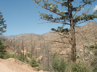
Lost Creek Wilderness, Pike National Forest.
Close up of the meandering Forest Roads taking you to the Wigwam
trailhead parking lot after turing off of CR 126. 
Views from my car window on CR 126.
Most of this road parallels this river's path.
The dirt roads of FR 211 reveals what remains of
past forest fires. 
Our GPS system shows that it can't locate where
the heck we were driving after we turned off of
CR 126 to begin the journey on FR 211 and beyond.
Personal Notes and Experiences 
Hiking "Wigwam trail" (and beyond!) was our first hike in Colorado. We intended to head to west to the mountains located within the Rocky Mountain National Forest near Estes Park, however, we realized that we did not have sufficient cold weather clothes to survive the near-freezing morning temperatures that were still present there in early June. So, we looked at options to the south from our large pile of free hiking trail brochures that we had collected from the REI flagship store. We chose Wigwam trial because it appeared to be a good middle milage and difficulty level for new hikers who still wanted a challenge. 

We finally found the trailhead after deciphering our
driving directions on the ambiguous FR leading us here!
New boots, new day pack... we
were looking pretty fly!
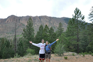
We were terribly excited to begin the trail on this sunny mid-morning, late spring day. We thought we were embarking on a 5-6 mile RT trail (as the topo trail map above shows), and with this being our first hike in Colorado, we planned on following the trail until we reached a "turn around" sign or a dead end of some sort.  So we set off, following the trail that twisted along side the Wigwam Creek, and we passed over the creek using various wooden plank bridges, counted as we went. Along our journey, we encountered two women campers who were very friendly, telling us that this was their favorite trail because of its quiet beauty. In fact, this trail was not very populated at all! We felt like the woods were ours. As we gradually ascended higher and higher through the shaded path, we saw beautiful views of adjacent orange rock-faced mountains and pine covered hills and valleys.

Crossing one of many bridges along
Wigwam Creek.
Stoney mountains all around us.
Eventually we passed an intersection with Goose Creek trail and Rolling Creek trail. Since Rolling Creek trail continued to the same direction of the Wigwam trail, we continued on that path thinking that we had not reached the end of Wigwam yet (there were no signs to turn around)!  The scenery was quickly changing from covered forest, to open prairie grass lands. Pines to aspens, and back to pines. 


We saw a beaver's dam, and applied additional layers of sunscreen to ward off the intense rays of sun that were now beating down on us. It was mid-afternoon and we were still heading outward. Suddenly, we stared questioning ourselves. Had we missed the turnaround point? We had been hiking over 2.5 hrs and surely we had to be reaching the end of the trail soon! We were walking at a fast clip, but then again this was our first time hiking "at altitude" so perhaps we were thinking we were going faster than we actually were. We decided to hike until our timers hit the 3 hour mark. Our major concern was our water supply. We had consumed half of the water already and we hadn't even turned around. We were quite thirsty and getting fatigued, but we decided to press onward. The end of the trail had to be around the next corner... or the next... or the next?  


During this last 30 minutes of travel outward, we started to climb upwards into the shaded forests once more, following a nice break walking through a flat grass-covered valley. At this point, we were stopping more. We knew we were hungry and thirsty, but we wanted to save a quality rest break to refuel and hydrate at our turn around point. Despite out mortal cravings for nourishment, we continued to be energized by all of the sights and smells that surrounded us. At 2:45 PM, just a few minutes before our 3 hr turnaround point, we surrendered to the mystery of this seemly never ending trail. Plopping onto some surrounding rocks, we snacked on energy bars, trail mix and consumed another half of our already half-empty water supply.   We had packed 2 liters of water in a new Kleen Kanteen bottle, thinking that we wouldn't need much for a 3 hour hike. But now we were 3 hours outward and still had to make the trek back to the car!  


Feeling more satisfied and energized after a 15 minute break, we packed up our things and began the journey back to our original starting point. We felt a bit defeated at the time, thinking that we couldn't finish our first trail hike, but we knew we couldn't put our health at risk with such a low water supply. We crossed paths with the two friendly women campers for a second time near Wigwam Park. We exhanged greetings and they asked us how we were enjoying our hike. We told them how we were disapointed in not making it to the end today, and then their eyes lit up!  This is the end of Wigwam trail here! You probably went an extra 3 miles out! This put a shocked look on our faces. Really?! No wonder we are so tiered! 12 miles for our first hike.  We had a smile on our faces the rest of the way back, and we made the return trip in record time since it was mostly downhill. At some point along this return trip, we established the fact that both of us were a bit dizzy and our legs felt like two dead weights mechanically stepping. But we did find ourselves square with a white tailed deer. A very special few seconds and the only encounter with wildlife the entire day! We downed the last few sips of  water 1 hour before crossing the finish line.

Located off of CR 126.

Once we reached the car and started to take off our hiking boots, fatigue finally tookover us. Joe had to rest at the wheel for a few minutes before starting the engine. We were very tired and thirsty and our bodies were sounding the "low fuel" alarms by bringing us two dull headaches that quickly matured into pounding mind bombs. Our watches read 6:15 PM as turned left onto the paved CR 126 heading home. We could have stopped at a local gas station to load up on snacks and fluids to get us home to Denver, but instead, we pulled off at the first descent restaurant that we came across, Zoka's Restaurant and Bar, to celebrate our accomplishment!  We were seated to a table for two and we requested orders of water and iced tea. We delayed ordering food until we felt hydrated again, and this was only accomplished after our waitress placed a pitcher of iced tea and water on the table, which both of us easily finished.  Where you two hiking? Inquired the curious waitress. Emily ordered the BBQ ribs dinner and Joe the Friday fish fry special. Turns out there was little conversation over dinner as both of us sought recovery in two different ways: Emily nearly finished her dinner plate while Joe continued to sip his ice tea and rub his head to dissuade the persistent waves of nausea that he was experiencing.

Zoka's Restaurant and Bar.
You could say we over did it! Upon arriving home and taking long hot showers, we assembled our blowup mattress sofas and spent the rest of the evening steaming movies on Netflix, eating reheated leftovers from our earlier meal and continuing to nosh on ice cream and popcorn. Neither of us had ever felt so beat!  We now respect the toll that altitude that take on the human body that isn't adapted.  The next time we visited REI we purchased a 2 liter Camelpak to complement our 2 liter Kleen Kanteen so that we would never go hiking with a limited water supply again.

Saturday, October 15, 2011

Introductions

Our first hike in Colorado,
Wigwam Trail, Pike National Forest.

As newly weds transplanted from the Upper Midwest to the mountainous state of Colorado, we were both a bit timid about what we would encounter in our new environment.  Settling into our small 1-bedroom apartment, our curiosities about those white capped peaks to the west became too strong to ignore. We postponed shopping for furniture (two blowup mattresses and sleeping bags functioned as a bed, a couch, and a kitchen table), to drive westward on I-70 into the majestic Rockies. One taste of the mountains and we become completely enchanted by their pine-scented breezes, whispering aspens, and daunting summits.  Hiking boots and a daypack became our first big purchases. Completing our first hike in Pike National Forest cemented the fact that exploring new hiking trails is something we wish to share together for the rest of our lives. A handwritten hiking journal was started to document these outdoor explorations, however, we both decided to transfer our entries to this blog for easier sharing with family, friends, and other hiking enthusiasts.  Thanks for joining us and happy trails!